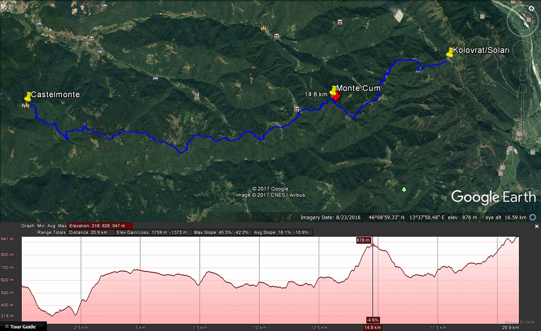
Google Earth says the stage was 21 km long, had 1700 m of ascent and 1300 m of descent, but I would rather believe the guide book, which says there was 1000 m of ascent and 600 m of descent and the length closer to 23 than 21 km. The profile shows that the path is quite lively with some steep slopes. With this in mind we wouldn't classify it as easy, but it is really easy to navigate, has no views and just right in the appropriate weather.